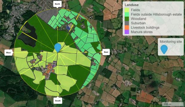
Ammonia emissions vary significantly across the landscape with point sources, such as animal houses and manure stores, and diffuse sources, such as manure spreading in fields, forming a patchwork of emission sources across the countryside.
The AFBI Hillsborough ammonia monitoring site is located to the northeast of the major farm ammonia point sources (animal houses and slurry stores), allowing us to see and measure the ammonia emitted from the sources. Depending on wind direction, the monitoring location sees different fields and farm ammonia sources, as can be seen in the map below. For example, under prevailing southwesterly winds, the farm’s livestock houses and manure stores are upwind of the monitoring site. Less frequently, the monitoring location picks up ammonia generated by surrounding agricultural sources, external to the Hillsborough estate and for which we do not collect activity data. This is particularly the case under northerly or easterly winds.
